


YORK 123 Voting District, DuPage County, Illinois
About
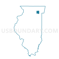
Outline

Summary
| Unique Area Identifier | 570716 |
| Name | YORK 123 Voting District |
| County | DuPage County |
| State | Illinois |
| Area (square miles) | 1.05 |
| Land Area (square miles) | 1.02 |
| Water Area (square miles) | 0.04 |
| % of Land Area | 96.58 |
| % of Water Area | 3.42 |
| Latitude of the Internal Point | 41.83708560 |
| Longtitude of the Internal Point | -87.93404770 |
Maps


Graphs
Select a template below for downloading or customizing gragh for YORK 123 Voting District, DuPage County, Illinois


Neighbors
Neighoring Voting District (by Name) Neighboring Voting District on the Map
- Proviso 134 Voting District, Cook County, IL
- Proviso 70 Voting District, Cook County, IL
- YORK 110 Voting District, DuPage County, IL
- YORK 120 Voting District, DuPage County, IL
- YORK 48 Voting District, DuPage County, IL
- YORK 82 Voting District, DuPage County, IL
Top 10 Neighboring County Subdivision (by Population) Neighboring County Subdivision on the Map
Top 10 Neighboring Place (by Population) Neighboring Place on the Map
Top 10 Neighboring Elementary School District (by Population) Neighboring Elementary School District on the Map
- Hinsdale Community Consolidated School District 181, IL (25,449)
- Western Springs School District 101, IL (10,175)
- Hillside School District 93, IL (5,713)
- Butler School District 53, IL (4,918)
Top 10 Neighboring Secondary School District (by Population) Neighboring Secondary School District on the Map
- Proviso Township High School District 209, IL (126,613)
- Hinsdale Township High School District 86, IL (74,146)
- Lyons Township High School District 204, IL (68,725)
Top 10 Neighboring Unified School District (by Population) Neighboring Unified School District on the Map
Top 10 Neighboring State Legislative District Lower Chamber (by Population) Neighboring State Legislative District Lower Chamber on the Map
Top 10 Neighboring State Legislative District Upper Chamber (by Population) Neighboring State Legislative District Upper Chamber on the Map
Top 10 Neighboring 111th Congressional District (by Population) Neighboring 111th Congressional District on the Map
- Congressional District 13, IL (773,095)
- Congressional District 3, IL (663,381)
- Congressional District 6, IL (657,131)
Top 10 Neighboring Census Tract (by Population) Neighboring Census Tract on the Map
- Census Tract 8185, Cook County, IL (5,682)
- Census Tract 8190, Cook County, IL (5,117)
- Census Tract 8446.02, DuPage County, IL (4,499)
- Census Tract 8446.01, DuPage County, IL (3,764)